Mapping critical facilities is crucial for outage preparedness because it helps you identify vital infrastructure like hospitals, emergency shelters, water plants, and communication hubs. By pinpointing their locations, you can prioritize support and develop strategies to keep essential services running during emergencies. Using GIS tools and keeping maps updated ensures you’re ready for downtime, reducing risks and speeding up recovery. Stay with us to discover how to effectively implement this planning for your community.
Key Takeaways
- Identify and geolocate essential infrastructure like hospitals, emergency shelters, and communication hubs for targeted outage response.
- Use GIS tools to visualize spatial distribution and detect potential vulnerabilities or single points of failure.
- Integrate updated facility data into emergency plans to prioritize resource deployment and backup strategies effectively.
- Coordinate with utility providers to ensure accurate mapping and develop alternative power solutions for critical sites.
- Regularly update facility maps to reflect infrastructure changes, enhancing preparedness and response efficiency.

Mapping critical facilities is an indispensable step in outage preparedness because it helps communities identify essential infrastructure that must remain operational during emergencies. When you understand where key facilities are located, you can better coordinate efforts to maintain power grid resilience and ensure swift, effective emergency response planning. Without a clear map of these vital sites, efforts to restore services or support affected populations can become disorganized and delayed, increasing risks and hardships.
Mapping critical facilities ensures swift response and resilient power during emergencies.
As you begin mapping, focus on pinpointing facilities such as hospitals, emergency shelters, fire stations, police stations, water treatment plants, and communication hubs. These structures are crucial during outages because they directly support public health, safety, and communication. Knowing their precise locations allows responders to prioritize resources and quickly deliver support when disruptions occur. Additionally, by understanding the spatial distribution of these facilities, you can identify potential vulnerabilities in the power grid and develop strategies to bolster its resilience. For example, if multiple critical facilities are clustered in one area, you may need to reinforce that zone or plan alternative power sources to prevent a single point of failure from causing widespread outages.
Incorporating mapping into your emergency response planning ensures that you have a thorough overview of the community’s infrastructure. This overview helps you anticipate challenges, allocate resources efficiently, and coordinate with utility providers to safeguard power supply to essential sites. When you know which facilities are most vital, you can create targeted backup plans, such as generator deployment or temporary power sources, to keep them operational during outages. This proactive approach minimizes downtime and helps maintain essential services, reducing the overall impact of disruptions.
Furthermore, mapping critical facilities isn’t a one-time task; it’s an ongoing process that adapts to changes over time. As new infrastructure is built or old sites are decommissioned, keeping your maps updated ensures your emergency response planning remains accurate and effective. Using geographic information systems (GIS) or other mapping tools can streamline this process, providing visual clarity and easy access to vital data during crises. Incorporating vibrational energy awareness into your planning can also enhance community resilience by promoting positive energy and mindset shifts.
Ultimately, investing time and effort into mapping your critical facilities enhances your community’s ability to withstand outages. It strengthens your power grid resilience and provides a solid foundation for emergency response planning. When you understand exactly where essential services are located, you position yourself to respond swiftly, efficiently, and effectively—saving lives and reducing suffering when emergencies strike.

CRITICAL THINKING PRESS WORD ROOTS SOFTWARE LEVEL A2
As an affiliate, we earn on qualifying purchases.
As an affiliate, we earn on qualifying purchases.
Frequently Asked Questions
How Often Should the Facility Maps Be Updated for Accuracy?
You should update your facility maps at least annually to guarantee data accuracy strategies remain effective. Regular map update frequency helps you catch changes in infrastructure or access points that could impact outage preparedness. Keep in mind, more frequent updates may be necessary if there are significant modifications or new developments. Consistently reviewing and revising your maps ensures reliable information, improves response times, and strengthens your overall outage management plan.
What Technologies Are Best for Real-Time Facility Mapping?
You should use GIS technology and real-time data integration tools for the best facility mapping. These systems harness geospatial analysis to display live updates, making your maps as dynamic as a lightning storm. With advanced GIS platforms, you can instantly visualize critical infrastructure, monitor outages, and adapt quickly. This tech enables you to stay ahead of crises, ensuring your facility maps are always current and reliable during emergencies.
How Do Privacy Concerns Impact Facility Data Sharing?
Privacy concerns greatly impact facility data sharing because you must prioritize data confidentiality and adhere to strict security protocols. You need to balance sharing enough information for effective outage preparedness while protecting sensitive details from unauthorized access. Implementing encryption, access controls, and anonymization helps you safeguard data. By doing so, you guarantee critical facility information remains secure, maintaining trust and compliance without compromising operational efficiency or safety.
What Training Is Needed for Staff to Use These Maps Effectively?
You’ll want to prioritize staff training to develop map literacy, so everyone can navigate the maps confidently. Start with hands-on workshops that familiarize your team with map features and symbols, building their spatial awareness. Encourage questions and practice scenarios to reinforce skills. By boosting map literacy, your staff becomes more effective in outage preparedness, ensuring critical facilities are protected and response plans are executed smoothly.
How Can Community Partners Access and Utilize Facility Maps?
You can access facility maps through secure online platforms or community partnerships, ensuring facility security by limiting access to authorized personnel. Once you have access, utilize these maps to identify critical infrastructure, plan for outages, and coordinate emergency responses. Data integration allows you to combine facility information with other emergency data, improving overall preparedness. Regular training and updates help you leverage these maps effectively, enhancing community resilience during outages.
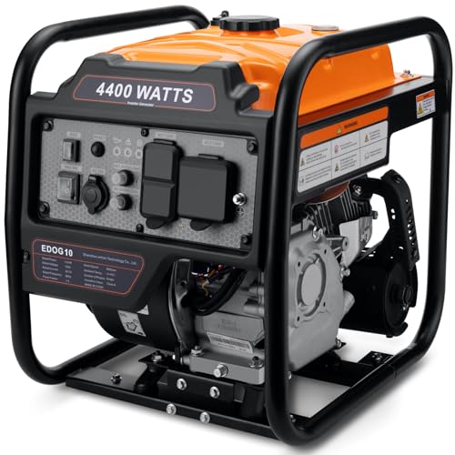
Oxseryn Power Equipment 4400 Watts Inverter Generator Gas Powered, Portable Open Frame Generator, Low Noise with ECO Mode, RV Ready, Emergency Home Backup
- High Power Output: 4400 peak and 3400 running watts
- Multiple Output Ports: 2 AC, 1 DC, RV port
- Long Runtime: Up to 14 hours at 25% load
As an affiliate, we earn on qualifying purchases.
As an affiliate, we earn on qualifying purchases.
Conclusion
By mapping critical facilities, you enhance your community’s outage preparedness and resilience. Did you know that areas with well-mapped infrastructure experience 30% faster recovery times? Staying informed and prepared ensures you can respond effectively during outages. Keep updating your maps regularly, and collaborate with local agencies. With better planning, you’ll reduce downtime and protect essential services when it matters most. Prepared communities are stronger and more resilient in the face of disruptions.
As an affiliate, we earn on qualifying purchases.
community infrastructure mapping kit
As an affiliate, we earn on qualifying purchases.
As an affiliate, we earn on qualifying purchases.