
El Niño changes ocean currents and affects atmospheric circulation, which can increase storm activity in some regions and reduce it in others. When warm water builds up in the Pacific, trade winds weaken or reverse, causing more moisture and energy in the atmosphere, leading to more intense storms like hurricanes and heavy rains. These shifts influence jet streams and weather patterns, making storms more frequent or severe where impacts are strongest. Keep exploring to understand how these changes unfold.
Key Takeaways
- El Niño weakens or reverses trade winds, allowing warm water to accumulate in the eastern Pacific, affecting regional storm activity.
- Changes in ocean currents during El Niño alter heat distribution, increasing moisture and storm potential in certain areas.
- Shifted jet streams during El Niño steer weather systems, often leading to more storms in some regions and fewer in others.
- Warm sea surface temperatures provide additional energy for storm development, increasing their frequency and intensity.
- Overall, El Niño’s ocean-atmosphere interactions cause regional variations in storm frequency and severity.
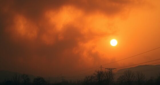
El Niño is a climate pattern that markedly influences weather around the world, often leading to more intense storms. When it occurs, it disrupts normal climate variability, causing significant shifts in weather patterns across different regions. This phenomenon primarily arises from changes in ocean currents in the equatorial Pacific, which, in turn, alter atmospheric circulation and weather systems globally. As ocean currents warm or cool, they influence the distribution of heat and moisture in the atmosphere, setting the stage for increased storm activity in some areas and calmer conditions in others.
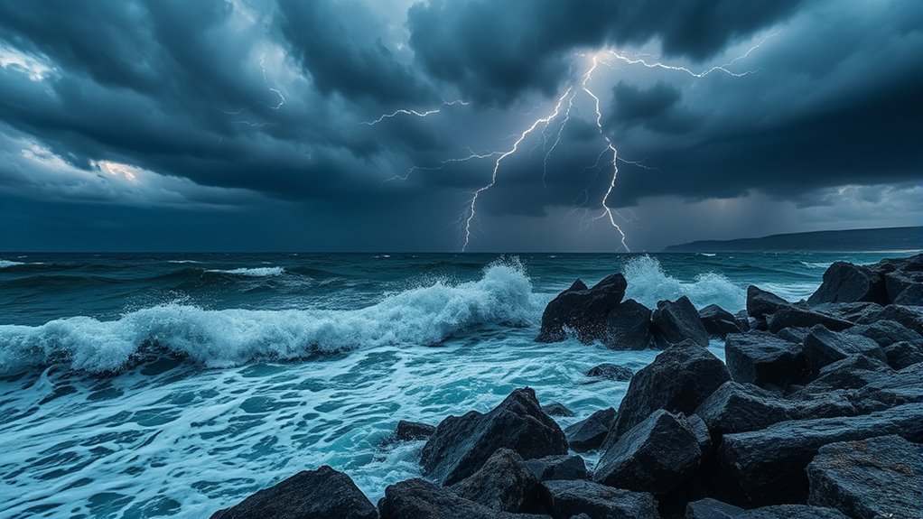
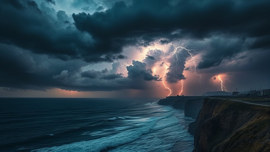
During an El Niño event, the usual trade winds weaken or even reverse, allowing warm water to accumulate in the central and eastern Pacific. This shift in ocean currents affects how heat is transported across the ocean surface, directly impacting regional weather patterns. The redistribution of warm water influences atmospheric convection, leading to increased moisture in the atmosphere over certain regions. This excess moisture often results in more frequent and intense storms, such as tropical cyclones, thunderstorms, and heavy rainfall. You might notice that some regions experience a surge in storm activity during El Niño years, while others face droughts or milder weather, depending on how the ocean currents and climate variability interact.
During El Niño, weakened trade winds cause warm water buildup, increasing storms and affecting regional weather patterns.
The changing ocean currents also impact jet streams—the high-altitude air currents that steer weather systems. During an El Niño, these jet streams tend to shift, creating more favorable conditions for storm development in certain areas. For example, the southern United States might see an increase in severe thunderstorms and hurricanes, as the altered jet stream pattern helps steer storms toward land. Conversely, regions unaffected by these shifts may experience fewer storms or different weather phenomena altogether. The influence of ocean currents on climate variability is essential because it determines the frequency, intensity, and paths of storms during El Niño events.
Understanding how El Niño impacts regional storm frequency requires recognizing the complex interplay between ocean currents and atmospheric dynamics. When ocean currents warm, they create the perfect conditions for more active storm seasons in some regions. Additionally, sea surface temperature plays a crucial role in driving these changes, affecting the overall energy available for storm development. Your awareness of these patterns can help you prepare for the fluctuations in weather that come with El Niño, especially if you’re in areas prone to storms. Knowing that ocean currents are at the heart of these changes underscores the importance of monitoring climate variability, as it directly affects your safety, infrastructure, and daily life during these dynamic periods.

EF ECOFLOW Portable Power Station DELTA 2, 1024Wh LiFePO4 (LFP) Battery, 1800W AC/100W USB-C Output, Solar Generator(Solar Panel Optional) for Home Backup Power, Camping & RVs
7 X Faster Charging. 0-80% in just 50 mins and 0-100% in 80 mins with AC input. That's...
As an affiliate, we earn on qualifying purchases.
Frequently Asked Questions
How Long Does an El Niño Event Typically Last?
An El Niño event typically lasts between nine to twelve months, but duration variability occurs due to factors like ocean temperature changes and atmospheric conditions. You should know that the intensity factors, such as sea surface temperature anomalies and atmospheric feedback, influence how long the event persists. While some El Niño episodes are shorter or more intense, overall, expect it to last around a year, impacting weather patterns markedly during that time.
Can El Niño Influence Global Weather Patterns Beyond Storms?
You’re in for a wild ride when it comes to El Niño’s influence on global weather patterns. It stirs up climate variability by altering ocean currents, which in turn impacts weather far beyond storms. This event can cause droughts, floods, and temperature shifts worldwide, acting like a ripple effect across the atmosphere. So, yes, El Niño’s reach extends well beyond regional storms, shaping the climate in ways you might not expect.
Are Some Regions More Resilient to El Niño-Induced Storms?
Some regions are more resilient to El Niño-induced storms due to geographic factors and regional resilience. You’ll find that areas with natural barriers like mountains or dry climates tend to experience fewer or less intense storms during El Niño events. These geographic features reduce storm impact, making certain regions better prepared to withstand El Niño’s effects. Understanding these factors helps you anticipate and adapt to storm risks in different areas.
How Do Scientists Predict the Onset of El Niño?
You can think of predicting El Niño as keeping a watchful eye on the weather. Scientists use satellite monitoring to track sea surface temperatures and atmospheric changes. They combine this data with climate modeling to forecast when El Niño might develop. By analyzing patterns and trends, they stay one step ahead, much like reading the signs of an approaching storm, to make early predictions about its onset and potential impacts.
What Are the Economic Impacts of Increased Storm Frequency During El Niño?
You face economic impacts like property damage, crop loss, and rising insurance costs during increased storm frequency in El Niño years. To manage these risks, climate adaptation becomes essential—building resilient infrastructure and implementing better land use planning. Insurance strategies also play a key role, helping you recover financially faster. Proactive measures reduce long-term costs, ensuring communities and economies are better prepared for the heightened storm activity associated with El Niño.

Jackery Portable Power Station Explorer 300, 292Wh Backup LiFePO4 Battery, Solar Generator for Outdoors Camping Travel Hunting Blackout (Solar Panel Optional)
Ultra-Lightweight: At only 7.5 lbs, the Explorer 300 delivers a robust 292Wh capacity while remaining 17% lighter than...
As an affiliate, we earn on qualifying purchases.
Conclusion
So, next time El Niño brings unusually calm skies, don’t celebrate too quickly. You might find yourself caught off guard when, suddenly, storms intensify instead of fade away. It’s ironic how something that often seems to bring stability can, in fact, *unleash* chaos in unpredictable ways. Just remember, nature’s surprises are rarely what we expect. So, stay prepared, because El Niño’s true power isn’t always what you see—it’s what sneaks up when you least expect it.
Anker SOLIX C1000 Gen 2 Portable Power Station, 2,000W (Peak 3,000W) Solar Generator, Full Charge in 49 Min, 1,024Wh LiFePO4 Battery for Home Backup, Power Outages, and Camping (Optional Solar Panel)
49 Min UltraFast Recharging: With upgraded HyperFlash tech, fully recharge at 1,600W—for outage prepping, camping trips, or tailgating...
As an affiliate, we earn on qualifying purchases.

DaranEner Portable Power Station, 192Wh LiFePO4 Battery Backup Solar Generator with w/2 300W (Peak 600W) AC Outlets, USB-C PD 60W Fast Charge, Power Bank for Camping, Outdoor, Home,Emergency
【192Wh Capacity, 300W Pure Sine Wave Output】This portable power station delivers a reliable 300W (600W surge) output, perfect...
As an affiliate, we earn on qualifying purchases.